Technology is Imperfect and People are Idiots
WHY oh WHY would you navigate by using a town name (or zip code) for destination to a new place and then follow those directions literally? Even if they’re as correct as possible, you’re going to end up on a random residential street in the geographical center of that town. Back in 2004 or so I took a trip with my then-girlfriend’s family to Belmar beach, NJ. The only problem: They mapquest’d directions to “Belmar, NJ”, which brought us to some random residential street quite far from the shore. Ignoring my advice to drive due east and figure it out from there (isn’t it all beach?) they eventually figured it out from a paper map. Mapquest took the blame for this though.
To be fair, back then I believe Mapquest only had a single overview graphic (maybe) but that’s no reason to not verify that your destination looks like how a beach should look on a map. Even in dialup days you should always wait for a satellite image of your destination to load. (incidentally, latency issues on satellite tiles make it feel like dialup sometimes). Debates of vectors vs tiles or cartography in general has always been something I stayed out of because I use all my mapping apps in hybrid (satellite + street names) mode.
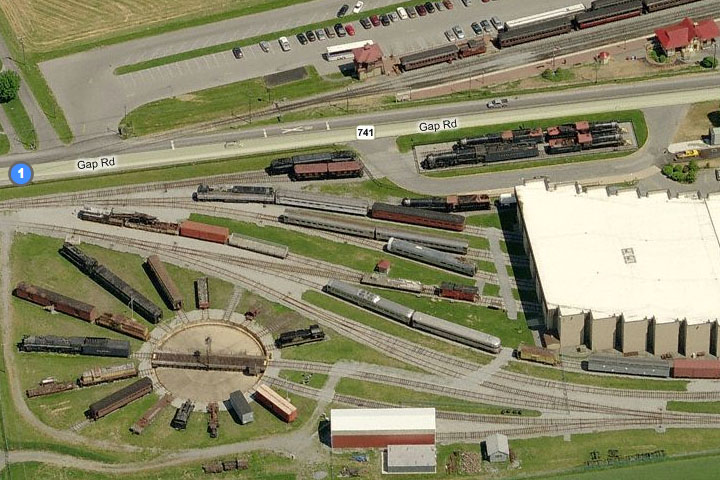
When I’m planning a trip to the Railroad Museum of Pennsylvania, I make sure it looks like a museum from space. Here’s the Bing “Bird’s Eye” view (why YES, you ARE allowed to use different mapping services for different reasons)
If I were to do something like just type in the town name, I’d get this (where the A is the town and off to the right you can see the museum)
“But, I want to do it eyes free, so I told Siri to-” Let me stop you right there by reminding you that TRIPS SHOULD BE PLANNED and if you’re already in your car and need directions to PULL OVER!
Now, in the spirit if getting lost, here’s one of the area’s countless corn fields
you’ll be sure to end up in if you set out to write a sensationalized piece on Apple Maps


